
Geotag your images online WITH NO LIMITS!
Geomakers is photo geotagging software that allows you to add unlimited tags. What do we offer? More features, better performance, the best price. Join over 1,200 monthly users.
No credit card. No registrer. Free forever
SALES
SALES
SALES
SALES
SALES
SALES
SALES
SALES
CHRISTMAS
CHRISTMAS
CHRISTMAS
CHRISTMAS
CHRISTMAS
Discover Geomakers
2:00 duration
Upload your pics
Select your images. Geomakers supports JPG, JPEG, PNG, and WebP formats.
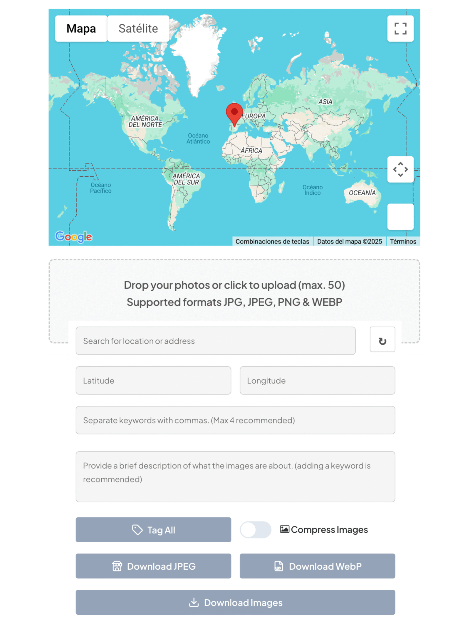
Add geotags to photos and other metadata
Add the location by typing it into the search bar or select the map if you need more precision. Then add your keywords together or customize each pic.
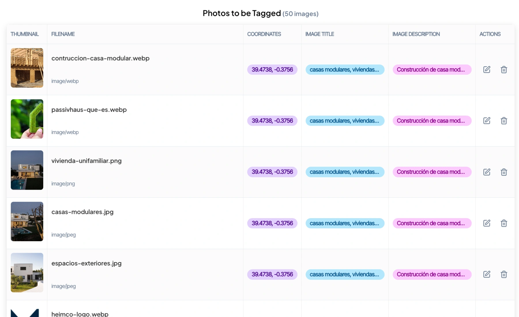
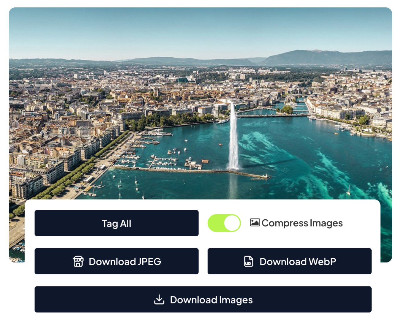
Compress and download!
You have the option to compress the images and download them in their original format or convert them to WEBP and JPEG. That’s it! Now you have your .zip file ready to send to your clients, upload to the Internet, add to GMB, or integrate into your catalogs and professional projects.
A geotagging software designed for you

Improve your SEO ranking
Companies that began including photos with optimized geotagging saw their visibility on Google Maps, Google Business Profile, and websites increase within a few weeks.
Improve the relevance of Local SEO in your business compared to the competition!
No limits!
Work without restrictions. The Unlimited version has no daily or monthly limits, so you can geotag your images without restriction. Perfect for SEOs, photographers, agencies, or professional teams that need constant productivity without worrying about usage limits.
Complete privacy
We do not store or share images on any third-party servers, APIs or tools, so you can work with your images securely and under your own control. You decide when to download them and how to use them, always maintaining a smooth and worry-free experience.

24/7 customer service
You never work alone. Our support team is available 7 days a week to resolve technical questions or incidents.
Pay less, geotag more
9 months FREE
Basic
Free
- Up to 2 images at the same time
- Compatible with JPG, JPEG, PNG y WEBP
- Max. 10MB per image
- Non-priority support
- No advertising
Unlimited
Best Seller 🔥
$9.99 COUPON: XMAS
$2.99/ month FOREVER
- ♾️ Unlimited images with no daily or monthly limits!
- Up to 50 images at the same time
- Compatible with JPG, JPEG, PNG, and WEBP
- Max. 15MB/image
- Image compression
- Conversion to WEBP & JPEG
- Integration with Google Maps + Google Place and customizable pin enabled for greater accuracy.
- Priority support 24/48 hours
- No advertising
Only €3.99/additional user!
Basic
Free
- Up to 2 images at the same time
- Compatible with JPG, JPEG, PNG y WEBP
- Max. 10MB per image
- Non-priority support
- No advertising
Unlimited
For a limited time 🤑
$99 COUPON: XMAS
$29/ year FOREVER
- ♾️ Unlimited images with no daily or monthly limits!
- Up to 50 images at the same time
- Compatible with JPG, JPEG, PNG, and WEBP
- Max. 15MB/image
- Image compression
- Conversion to WEBP & JPEG
- Integration with Google Maps + Google Place and customizable pin enabled for greater accuracy.
- Priority support 24/48 hours
- No advertising
Only €3.99/additional user!
They restrict, we hear you!
GeoMakers
Competitors
Advantage
Price
2.99$/month
Between 12.90-19.99$/month
✅ More economical
Monthly limit
♾️ Unlimited
Between 400–1,000 images/month
✅ NO LIMITS
Batch upload
50 images
Between 5-20 images
✅ x2.2 more capacity
MB/image
15MB/image
10MB/image
✅ More flexibility
Compatibility
JPG, JPEG, PNG & WEBP
JPG, PNG & WEBP
✅ Similar
Comprehension
JPG, JPEG, PNG & WEBP
No functionality / JPG & PNG
✅ All formats
WEBP & JPEG conversion
Yes
No
✅ Exclusive
Additional users
+3.99$/usuario
Desde +4,28$/average
✅ Cheaper
In summary
🏆 More value at the lowest price
Limited by volume, reduced functionality, and higher price
FAQs
What does geotagging a photo mean?
Geotagging a photo means adding GPS coordinates (latitude and longitude) to the image file. This information is stored within the EXIF metadata and allows you to know where an image was taken or to which location it belongs. It is not visible in the photo, but is integrated into its technical information.
Why is it important for Local SEO?
Geotagging offers great advantages for search engine optimization (SEO), especially for photographers, local businesses, and content creators. By adding GPS coordinates to your images, you help search engines better understand the geographic context of your content, thereby improving your ranking in local results.
When you geotag your photos, search engines can categorize them more accurately and display them in relevant searches based on location. This rich metadata increases the visibility of your images in search results and strengthens the local SEO of your brand or business.
Images with precise coordinates are more likely to appear in local searches and queries related to specific locations, which translates into increased organic traffic. GPS data acts as structured signals that Google and other search engines value when evaluating a site’s relevance and authority.
More and more agencies and SEO experts are integrating geolocation into their digital marketing strategies. Google’s algorithms reward content with location data, making geotagging an essential tool for those looking to stand out in their local area.
Consejo profesional: combina el geoetiquetado con palabras clave locales y descripciones detalladas de ubicación. Esta combinación potencia al máximo el rendimiento SEO de tus imágenes y mejora su posicionamiento en los motores de búsqueda.
Can I change or edit the geolocation of an image?
Of course! If an image already had coordinates and metadata tags, you can modify them using the software, adding the new location from the map/search engine and entering the new tags manually. Even if the photo didn’t have original GPS data, you can assign it a new location and keywords in seconds.
What happens to my original pics?
Your original photos are never modified. We generate new copies with the location and tags added, so your original images always remain intact and secure.
Can I add geotags to photos online for free?
GeoMakers offers a free version that allows you to geotag up to 5 photos per day online, without installing anything and without needing a card. Just upload your images, choose the location, and download the result.
Do I need technical knowledge to use GeoMakers?
No, the program is designed for all types of users, from beginners to professionals. Just upload your images and follow a few guided steps. You don’t need to install any programs or know anything about EXIF or coordinates.
Can I geotag from my phone?
Of course! The geolocation tool is fully compatible with mobile phones, tablets, and computers. Its responsive design automatically adjusts the interface to the size of your screen, so you can easily locate your photos from any device.
How can I cancel or modify my subscription?
You can cancel your subscription at any time from your user area. If you paid with Stripe or PayPal, you can also manage it directly from your account. There are no minimum contract periods or penalties: you only pay for the time you want to use the service. We’ll just miss you 😭
More performance, more economical
Improve your ranking
+200,000 geolocated images
+1,200 users worldwide
Our mission is to make work easier for everyone. That’s why we offer you more capacity with no usage limits, perfect for your day-to-day life.


geomakers
© 2025 GeoMakers. All rights reserved.